The UN General Assembly has adopted a resolution urging the use of a new world map projection that shows the African continent closer to its true size. The measure was backed by 164 countries, while the United States voted against it.
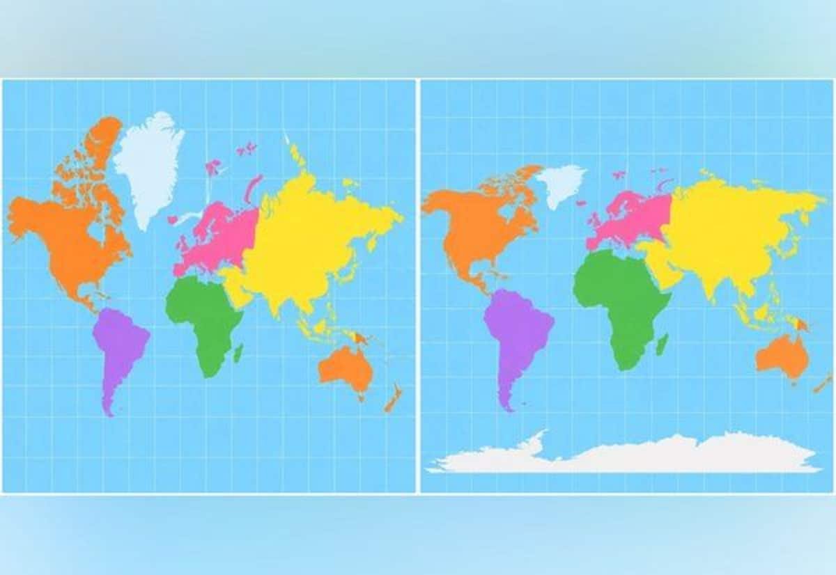
For centuries, the Mercator projection—created in 1569 by Belgian cartographer Gerardus Mercator—has been widely used to represent the world on a two-dimensional map. It was designed to aid sea navigation, but it also distorts land areas.
Under Mercator, regions in the far north and south appear larger than they are, making areas near the equator look comparatively smaller. As a result, Africa and South America are often visually reduced, while Europe and North America appear oversized.
To address this, cartographers developed the “Equal Earth” projection in 2018, aiming to present continents in proportions closer to their real land area. In this projection, Africa, South America, South Asia and Oceania appear larger than they do on Mercator maps.
Following the vote, France—one of the supporters—said it would move away from the Mercator projection. French Foreign Minister Jean-Noël Barrot said changing a map may not change the world, but correcting misrepresentation helps uphold the truth.